All Categories
-
- Audio and Entertainment
- VHF Radios, Hailers & Accessories
- EPIRB, PLB, and AIS Systems
- Display Mounts & RAM Mounts
- Marine Security Systems
- Marine Cameras
- AIS, AM/FM, CB, & TV Antennas
- Fishfinders & Chartplotters
- GPSs & Multifunction Displays
- Marine Radars & Autopilots
- Transducers & Sounder Modules
- Boat Compasses
- Network Accessories & Software
- Satellite Receivers & Telephones
Top categories


-

FREE SHIPPING
on all orders over $99!
-

45-DAY RETURNS
so you can get the right parts
-

REWARDS ON EVERY PURCHASE
earn up to 4.5% back
-

PREMIER CUSTOMER SERVICE
throughout your buying journey
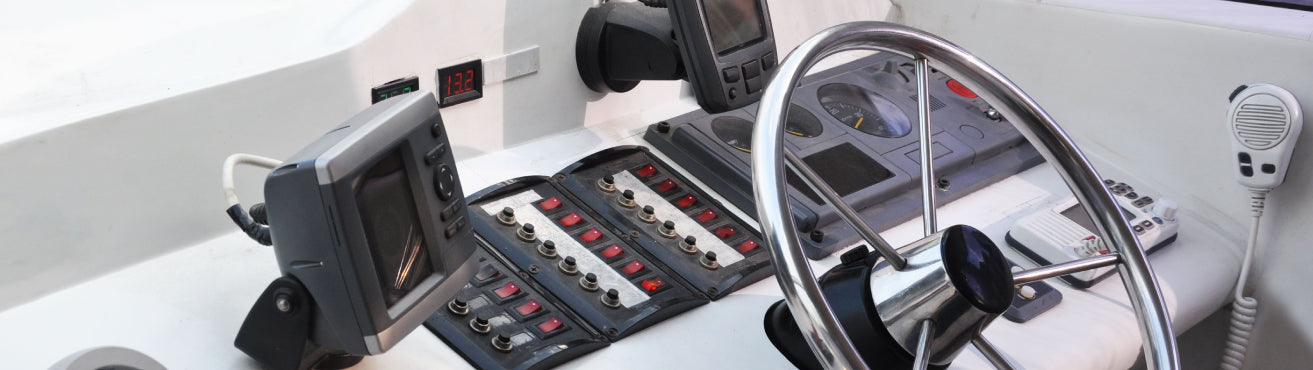
Marine Electronics and Navigation Resources and Information
Upgrade your boat and stay up to date with the latest marine electronic components and accessories. PartsVu is pleased to offer an extensive selection of marine electronics and navigation, including a wide assortment of products from Garmin, like: Garmin GPS navigation systems, Garmin GoPro, GoPro parts and accessories and Garmin VHS communications systems.
Choose from our full selection of marine accessories, or browse marine electronics and navigation products by category, including:
- Audio and Entertainment
- VHF Radios, Hailers & Accessories
- EPIRB - PLB - AIS Systems
- Display Mounts & RAM Mounts
- Marine Security Systems
- Cameras
- AIS - AM/FM - CB - TV Antennas
- Fishfinders - GPS - Chartplotters - Multifunction Displays
Marine Electronics and Navigation FAQs
What are some of the most popular marine GPS units?
The Humminbird HELIX 5 Chirp DI GPS G2 is a five-inch, color screen GPS unit features high sensitivity down-imaging sonar, giving you a fish-eye’s view of everything that’s happening under your boat.
With a max depth of 600 feet below your boat, you’ll be able to make the most of your fishing trip. The HELIX 5 CHIRP DI GPS G2 has a range of features, including SmartStrike– a feature that takes you straight to the action by showing you where the fish are biting at any given moment. The patent pending AutoChart Live allows you to create digital, detailed maps live and on the water, or enhance existing maps in the system. Illuminated by its high definition display, your maps will look better than ever.
These features are practically unbeatable at this price point, making the Humminbird HELIX 5 CHIRP DI GPS G2 a great choice for any angler.
The Humminbird HELIX 7 CHIRP MEGA SI Fishfinder/GPS Combo G3N features a larger 7” display and many of the features you’d expect from Humminbird: MEGA Side Imaging, providing crystal-clear viewing out to 125 feet on either side of your boat; Dual Spectrum CHIRP; SwitchFire Sonar, which allows the user to add or remove detail, account for water depth, temperature, turbulence, and more; Bluetooth capabilities; and more.
One of the benefits of a larger, ultra-wide display screen is the option to choose between pre-loaded split screen options. The 480×800 screen provides a fantastic display, so you can use the Humminbird Basemaps with spectacular clarity.
When it comes to robust features and popularity amongst the PartsVu community, the SOLIX 10 CHIRP MEGA SI Fishfinder/GPS Combo G2 has both. Its features build on those of the previously mentioned HELIX 7 CHIRP MEGA SI GPS, including more powerful MEGA Side Imaging up to 200 feet.
Some of the added notable features include Cross Touch Interface, which allows you to control your fish finder using the touchscreen or the keypad. Cross Touch lets you quickly and intuitively access technologies on your terms, no matter your situation and conditions. With added NMEA 2000® Networking capabilities, the SOLIX 10 CHIRP MEGA SI Fishfinder/GPS Combo G2 is practical, easy to use, and fully designed with the user in mind. While the price is steeper than some may prefer, it’s well worth every penny.
What are some of the most popular boat stereos?
The Fusion MS-RA55 stereo is one of the best entry-level options for marine entertainment. The compact MS-RA50 is perfect for smaller vessels and is capable of powering a set of boat stereo speakers. It features a large LCD display, a water-resistant seal, iPod, and iPhone playback, and it’s extremely easy to use.
The Fusion MS-RA205 compact stereo includes SiriusXM, USB connectivity, a VHF receiver, Bluetooth audio streaming, iPod/iPhone playback with video, and Android or Windows phone connectivity. It also allows you to enjoy different volumes in different parts of your boat. The water-resistant MS-RA205 was made to withstand the harsh marine environment’s salt spray and humidity.
The Fusion MS-UD650 is a top of line, marine entertainment system with a widescreen display and a water-resistant charging dock. It provides loud and clear audio with Apple, Android, Windows, and USB devices, and has Bluetooth and SiriusXM capability as well. And with Multi-Zone™ Technology, you can enjoy different volumes in three separate parts of your boat.
What is a VFH handheld radio?
VHF radios are another must-have for every boater, mainly because of their ability to enhance safety. The U.S. Coast Guard constantly monitors Channel 16, the international distress communication channel, so you can rest assured knowing you’ll be able to quickly find help in case of an emergency. As it’s much more reliable than a cell phone, a mantra of mariners is that the VHF radio is the first thing thrown in the ditch bag before abandoning ship.
Icom engineered the first floating VHF marine radio, and the Icom M25 also has a flashing light feature that activates upon impact with the water, even if the power is off! With 11-hour battery life, convenient USB charger, and instant access to Channel 16, this radio is one of the best. It also features AquaQuake™ which drains the speaker of water.
Specifically designed for marine use, the Icom M36 automatically detects and reduces background noise such as breaking surf and engine noise, to provide the clearest transmissions. It also floats, is waterproof, and has AquaQuake™ functionality. The M36’s slender body and large buttons make it one of the most convenient portable radios.
The Icom M93d with DSC features a built-in Class D DSC, a red rear panel button that allows for distress calls, 50 waypoint memories with an alphanumeric name for navigation, active noise-canceling digitally removes background noise from both transmit and receive audio, a weather channel with alert functionality, and Float’n Flash allows the user to see the radio when dropped in the water.
How do I select the best chartplotter for my boat?
If you are in the market for a new chartplotter, you are likely weighing several factors—budget, screen size, and functionality, just to name a few. This article is designed to provide you with a foundation of how this navigation technology works and questions to ask yourself as you journey through your decision-making process.
First, let’s look at the basic purpose of a chartplotter. While this might be a very elementary point, it is an important foundation. The chartplotter’s job is to show you where you are in the water and to help you navigate to where you are going. That sounds a lot like the GPS in your car, right? Yes and no.
While the chartplotter is run by a GPS similar to what is used within on-land devices, there are additional factors at play on the water, so the functionality and ability to process large volumes of complex data is vital. If the size and structure of the body of water you’re navigating is small and uncomplicated, you can simply type in a destination and a route will be generated for you to follow. However, on larger bodies of water with more complexity, you will likely need to enter waypoints and build a custom route.
Like the GPS in your car, a chartplotter uses GPS or GNSS data to measure bearing, speed, and direction to successfully navigate your route. However, the chartplotter begins to differ from the GPS in your car as you start considering its tracking and route navigation capabilities. A critical element that you must navigate while in the water is the underwater structures that can obstruct your route.
Structures like reefs, sandbanks, wreck sites, and other hazards must be avoided. A chartplotter’s ability to generate detailed electronic charts is another area in which this device differentiates itself from other navigational tools. A marine chartplotter will produce two types of charts: a raster chart, which is basically a scanned version of a paper chart; and a vector chart, which is composed of lines, points, and polygons using information pulled from a database. Vector charts are more dynamic, use less memory, and are more user-friendly than raster charts. In addition to being powerful navigational tools, many of these devices include fish finder functionality that detects sound waves underwater and uses the signals to project an image onto the screen to enable anglers to spot schools of fish in the depths.
PartsVu stocks an extensive selection of GPS navigation systems, fish finders, boat audio and entertainment systems, VHS radios, EPIRB systems, and much more. Boss Marine Audio systems, Minn Kota anchoring systems, power props, battery charge detectors, marine stereos from Fusion Electronics, and more.